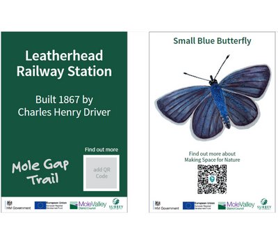
Mole Gap Trail
6 miles
Station to station
The Mole Gap Trail offers the opportunity to visit two historic market towns and the outstanding countryside of the Mole Gap, including England’s largest vineyard. You will discover a river that has carved a route through the chalk of the North Downs, some of the best ancient yew and box woodlands in Europe and historic parkland that has inspired famous writers and artists through the centuries.
The walk starts from Leatherhead rail station and finishes at Dorking rail station. The return journey is a simple 5 minute train ride. You’ll be guided through the history, heritage and habitat of the Mole Gap Trail by scanning our QR codes waymarkers along the way.
Please note that there is currently a diversion in place for this route. The map below has been updated accordingly.
Plan your route
Leatherhead station, KT22 7SQ
What3Words ///invest.early.rock
Dorking station, RH4 1TF
What3Words ///wasp.manliness.bake
Leatherhead station, KT22 7SQ
Dorking station, RH4 1TF
Bus service 465
Banstead, Epsom, Dorking and Leatherhead bus timetables – Surrey County Council
Leatherhead station, KT22 7SQ
Dorking station, RH4 1TF
| Toilets | Yes | Leatherhead and Dorking station, as well as toilets within hospitality facilities along the route. |
| Seating | Yes | Benches throughout the route |
| Gates | Yes | |
| Stiles | / | Audit in progress |
| Terrain | / | Audit in progress. Pavement in town centres and woodland paths that can be muddy and have exposed tree roots. |
| Incline | Yes | This route has some steady uphill and downhill inclines. |
| Waymarked | Yes | Waymarking will guide you throughout the entire route. |
- Leave Leatherhead Station via platform 2 exit, turn right and follow footway to main road. Cross road at pelican crossing, and enter park opposite. After a few steps, bear left and take diagonal path through centre of park. At next path junction keep ahead into corner of park to road.
- Cross road using pelican crossing. Turn left and walk towards town centre. Bear right towards town centre passing War Memorial on left. At the corner with Bridge Street turn right and down towards river, passing The Running Horse Public House on right.
- Cross road on far side of mini-roundabout just before Town Bridge, and walk over bridge. Turn left immediately after the bridge and follow path alongside River Mole. Keep straight ahead on public footpath, past football ground and leisure centre, then skirting grounds of Thorncroft Manor. At end of footpath turn right onto tarmac drive (Thorncroft Drive). Continue along drive passing entrance to Thorncroft Manor. At waymark post turn left off drive onto path and through metal kissing gate. Follow path through field to kissing gate. Keep ahead and follow path along riverside, passing through underpass.
- Keep ahead, and through kissing gate into Norbury Park. Walk across field, then bear right uphill to join track. Keep ahead on track through kissing gate. At cottage turn right through kissing gate, up hill, and under railway bridge. Turn left soon after bridge and up steep path. At tarmac drive turn left downhill to wooden bench on right. Just past bench bear right uphill on grassy path to surfaced track. Cross over and go ahead downhill into woods. Take second footpath on left, down through kissing gate into picnic site. Leave picnic site through kissing gate on far side and keep ahead on track with fields on each side. At Lodge Farm, follow track left then right then ahead over bridge over River Mole. Continue along track to farm buildings then turn right along track and past Cowship Cottage. Continue ahead along path and through three kissing gates to footbridge over River Mole. Cross river and follow path ahead to kissing gate and to Westhumble.
- Cross over Chapel Lane and turn right along footway. Continue along footway where it separates from road, passing Pilgrims Way. Continue ahead with care along Chapel Lane for 25 metres then turn left down narrow path between fences and hedges. Continue ahead crossing over road to kissing gate into field. Continue ahead across field and through kissing gate to stone track. Continue ahead through gate into vineyard. Keep ahead on wide track through vines and crossing over drive. Keep ahead uphill. Where main track turns right keep ahead on grassy track. Go through metal kissing gate and ahead uphill with trees on right.
- At path junction keep straight ahead and descent into Yew Tree Road, keeping ahead to Ashcombe Road. Turn left and follow the path alongside road. Turn right across road at a waymark post and take narrow path straight ahead with school playing fields on left and cross over railway bridge into Meadowbank Park. Keep straight ahead on path with hedge on right hand side, past the football ground. Keep ahead to exit Meadowbank and up the road (Mill Lane) with shopping centre on right. At the junction with High Street turn left. Keep straight ahead until Pippbrook council offices. Turn left and follow the signs to Dorking railway station keeping the council offices on you right and following the footpath left past Pippbrook House. On reaching Old London Road turn right, crossing the road at the traffic island. Keep ahead to London Road. Turn left and right at the pedestrian crossing to Deepdene Railway Station opposite. Dorking Mainline station is a short distance further along on the right.